
The only possible pre-Roman deposits identified on the site were situated in Trench 12. These comprised two linear gullies and two pits, the locations of which are indicated in Figure 17. These features have been assigned to Phase 3 on the basis of their stratigraphic position, orientation and aceramic fills.

Figure 17: Plan of Phase 3 features, Trench 12
Gully [1259] was a linear feature oriented roughly northeast-southwest and cut into the natural sand at the northern end of Trench 12 (Figure 18). The exposed dimensions of the cut were 9.8m long, 0.38m wide and 0.33m deep with a ‘U’ shaped profile. The fill, context (1258), was a mid-brown sandy loam. The fill contained no pottery, though three unidentified iron objects were recovered, alongside ten fragments of briquetage and four fragments of undiagnostic fired clay. The briquetage fragments were all small undiagnostic pieces, and may have been worked into the fill at a later date from overlying deposits. The upper surface of fill (1258) was recorded at a height of 32.48m AOD.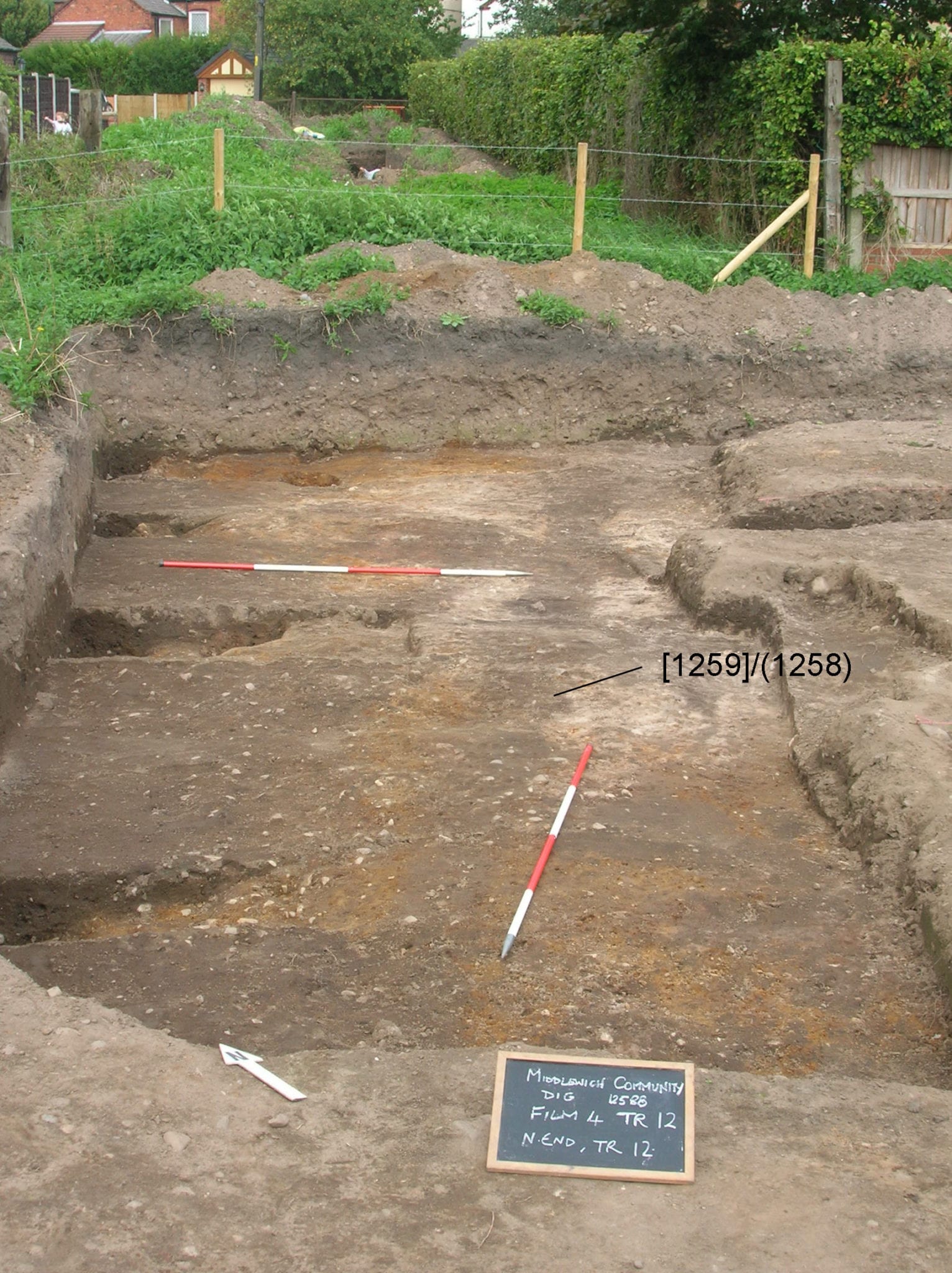
Figure 18: Gully [1259]
The orientation of this feature did not appear to respect any of the later features in the trench.
A second gully was observed at the southern end of the trench. Its full extent was not established as it was seen running beneath cultivation soil (1219) in two separate sections. The cut, context [1296] was 0.6m wide and 70mm deep with a shallow concave profile. The fill, context (1295), was a soft brown sandy loam; no artefacts were recovered from this fill.
Pit [1250]=[1252] (Figure 19) was situated in the south-western corner of the trench and was also sealed by cultivation soil (1219). The cut was at least 0.65m in diameter and sub-oval in plan, with sharply concave sides leading to a base 0.32m below the top of the visible cut, a depth of 31.86m AOD. The fill, context (1251), was a pale grey sandy loam, containing no artefacts.
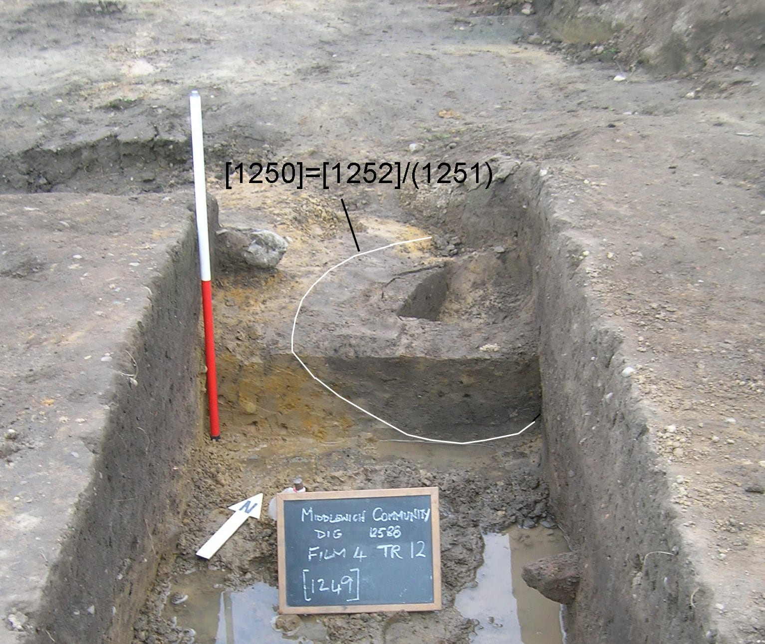
Figure 19: Pit [1250]=[1252]
Finally, pit [1273] was situated in the western half of Trench 12, and was seen following the removal of the backfill from John Bestwick’s trench (Figure 20). The pit cut a pre-Roman buried soil (1293), and appeared to be oval in plan though the full extent was not exposed. In section the pit was 3.3m wide and over 0.4m deep, though the full depth was not established due to the high water table.
The earliest fill, context (1274)=(1278), was a dark grey/brown sandy silt up to 0.3m deep. This was overlain by heavy black silty clay (1272) up to 80mm thick which possibly represents a buried turf, and this was in turn sealed by a layer of buried soil (1271) (see Phase 7). No artefactual material was recovered from these fills.
Figure 20: Pit [1273]