
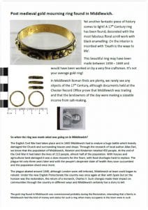
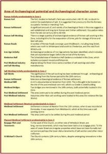
 Yet another fantastic piece of history comes to light! A 17th Century ring has been found; decorated with the most fabulous floral scroll work with black enamelling. On the interior is inscribed with ‘Death is the waye to life’.
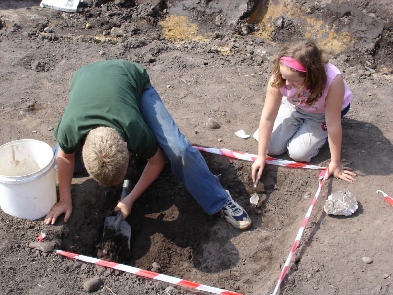
 This document looks at the history of Middlewich that can be extracted from archaeological data.
To read this document click on the link:
 This document looks at the potential for archaeoloigical
research and briefly looks at some of the work already done.
To read this document click on the link below
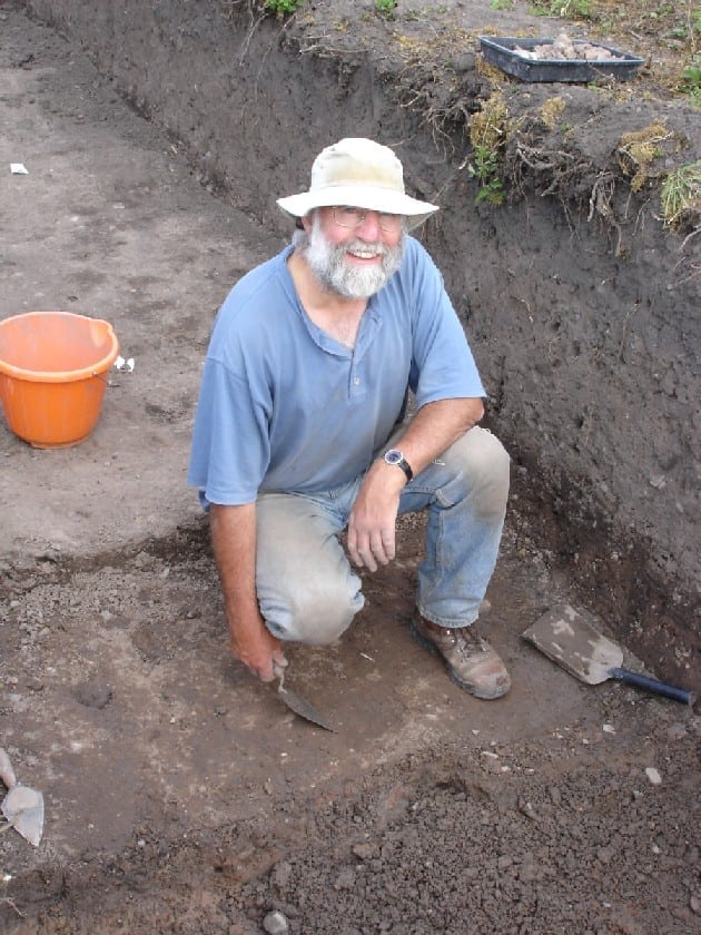
Roman Archaeology Dig Sites – latest finds from Jersey Way, Middlewich by Oxford Archaeology North
Information snippet on the Archaeological Dig
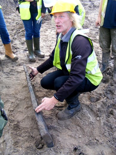
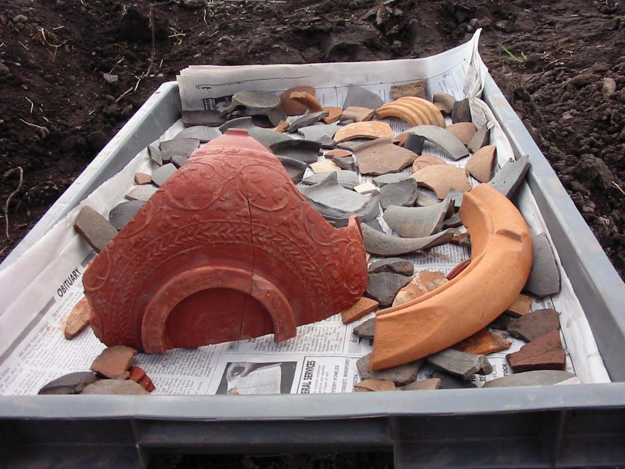
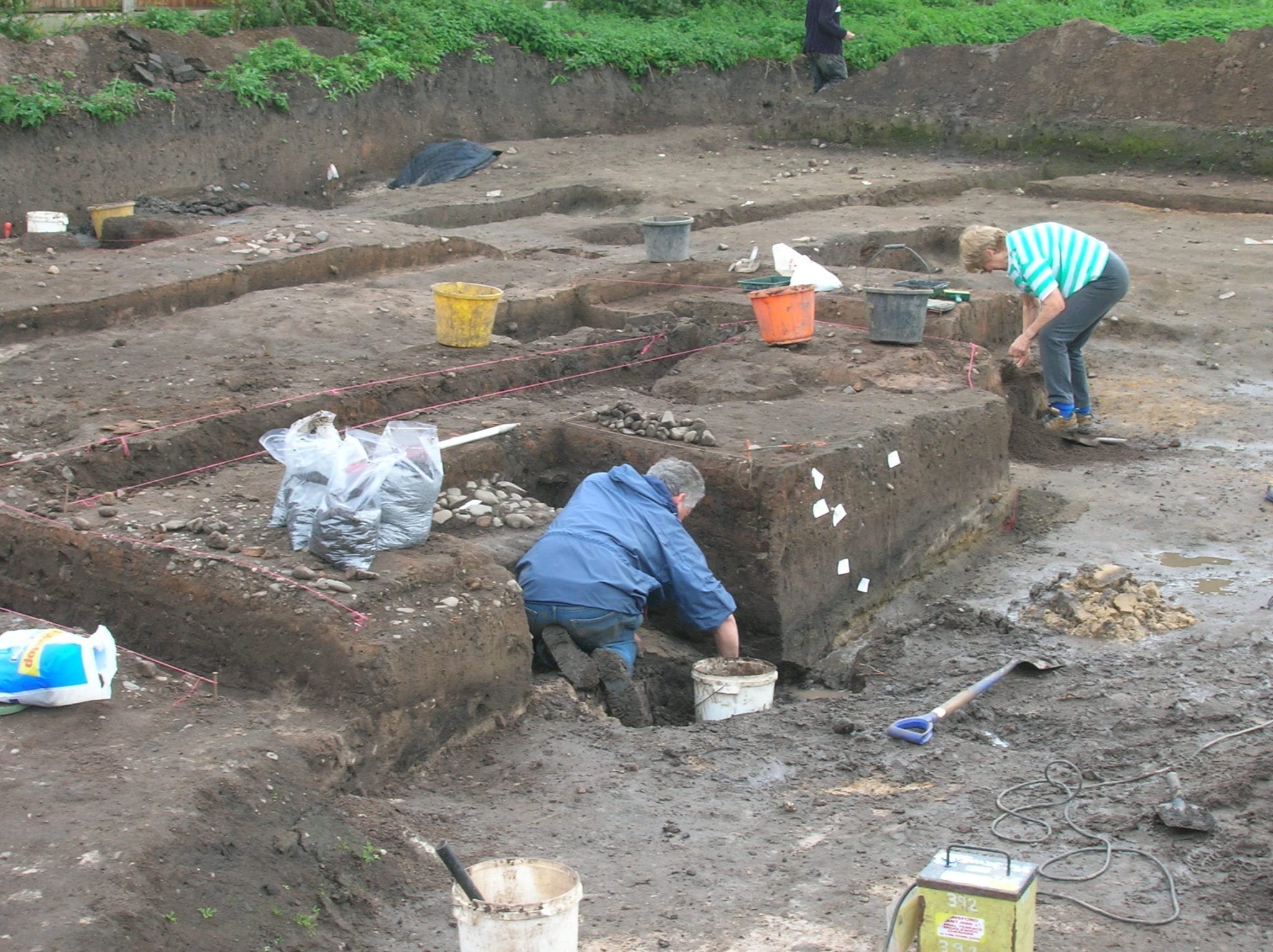
Paragraph by Ian Miller of Oxford Archaeology North. Photos from OAN and Kerry Fletcher. The full report may take up to a year but will be posted on this website.
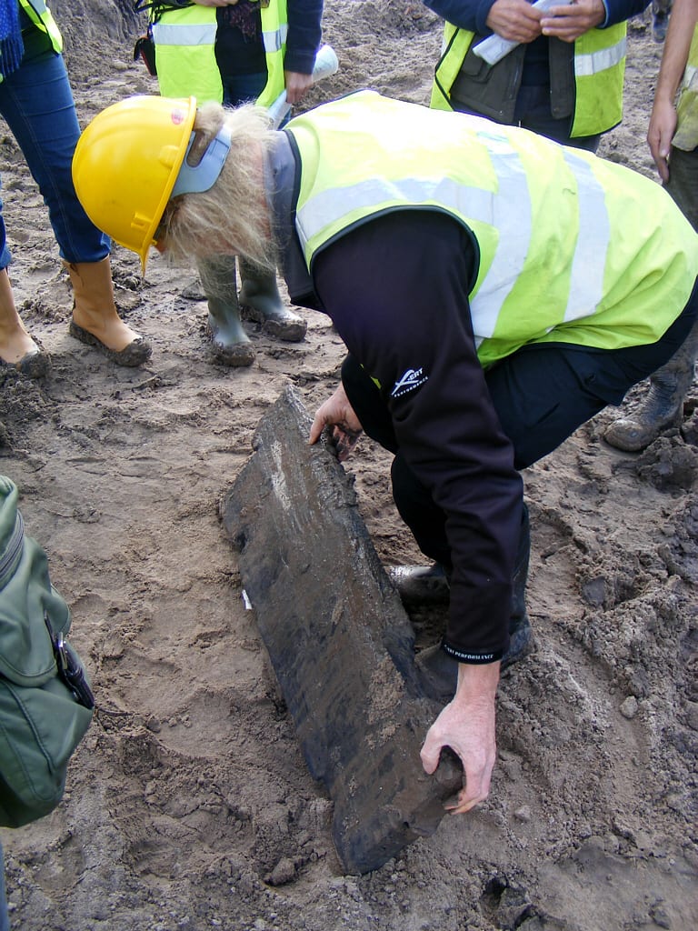
We spent nearly three months excavating the site on Jersey Way. The fieldwork is very much a data-gathering exercise, generating the information that we will interrogate as part of the post-excavation process to come up with a detailed account of what was happening on the site and exactly when. However, we have got a pretty good idea of what’s going on at this stage, although the precise dating is somewhat provisional.
Our current thoughts are that the site was first occupied during the middle of the first century – we don’t have any firm evidence for any Iron Age activity on the site, although this could come to light during the post-excavation process when we’ve had a proper look at all the pottery and have carried out some radio-carbon dating. It seems that the earliest Roman features on the site are a series of shallow ditches. We often find similar features on Roman sites, and generally consider them to be boundary ditches, rather than purely for drainage. There is certainly good evidence elsewhere for the Roman military laying out ‘development plots’ when they first arrive at a site that they intend to settle, and mark these plots by digging shallow ditches.
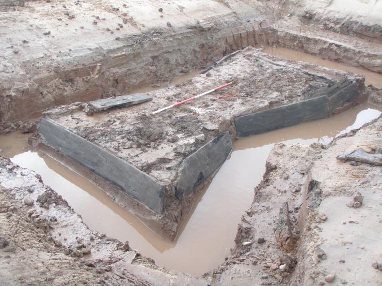
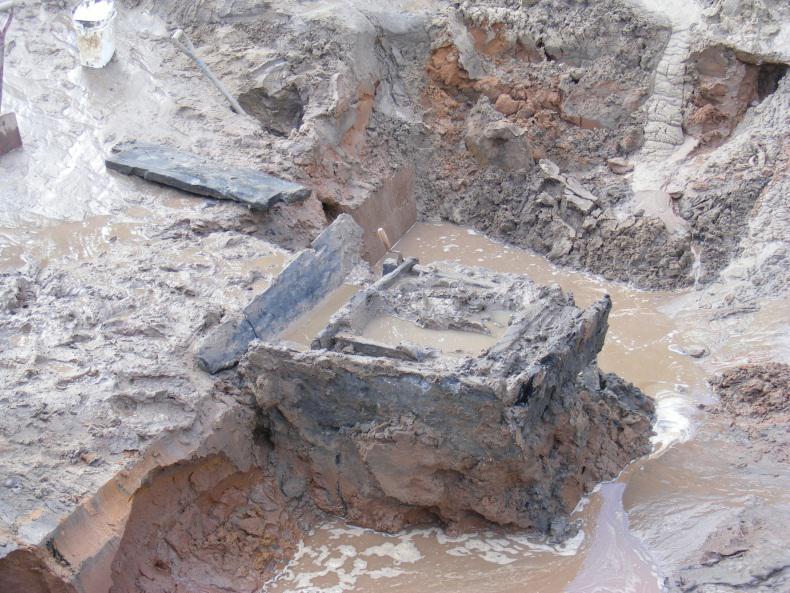
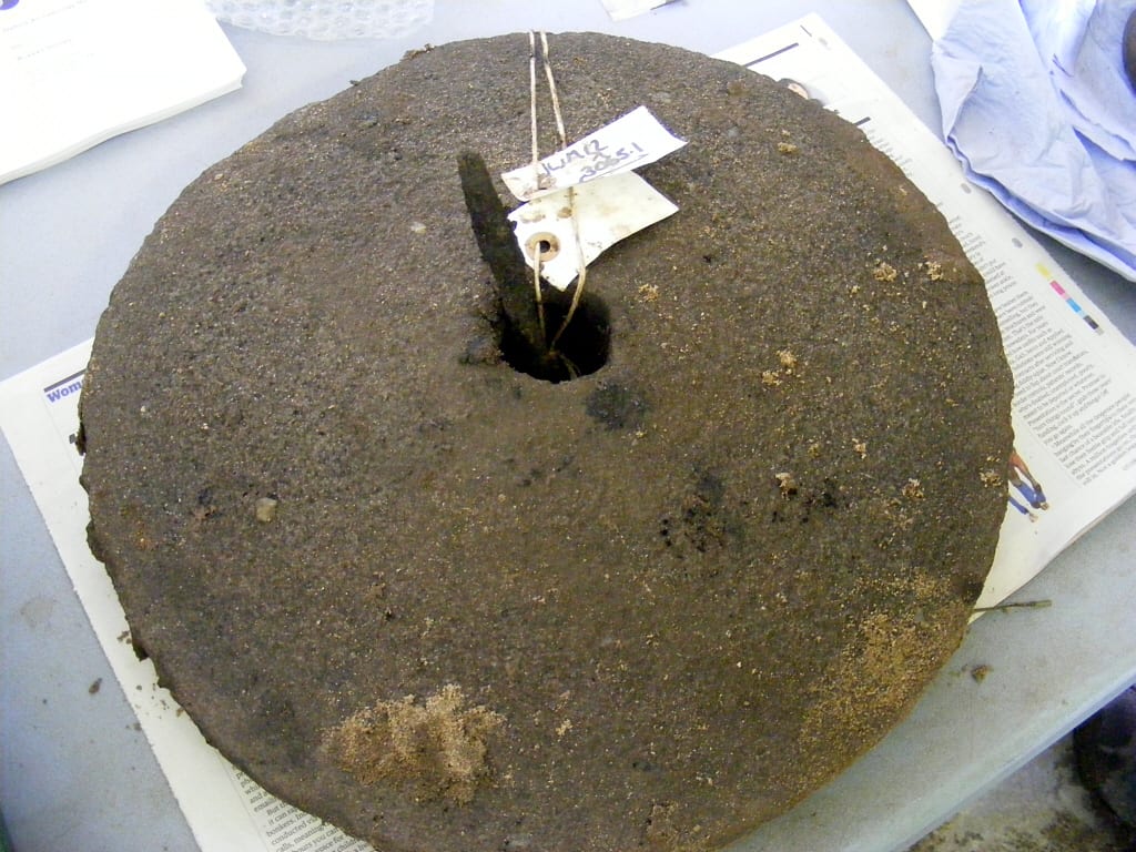
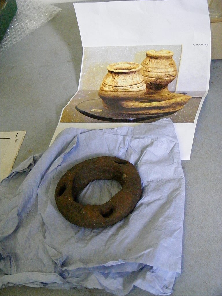
The main thrust of Roman activity on the site is salt-working, and the excavation has allowed several timber-lined wells (or probably brine springs, shown above left), a brine storage tank (above right) and a boiling hearth to be recorded. In addition, we have plenty of fragments of briquetage, which almost certainly represents the vessels in which the brine was stored after boiling. A large sheet of folded lead that had been put into the brine well before it was backfilled could be part of a Roman salt pan.
Trajan Coin
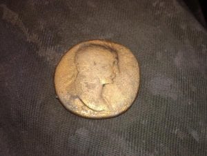 It looks like this industrial activity started in the latter years of the first century, with salt production continuing until the middle of the second century. We did find a coin at the bottom of one of the brine wells, which is an issue of Trajan. However, looking at the wear of the coin, we think that it was probably dropped into the well in c 140-160 AD, immediately before the well was backfilled and abandoned. We were very excited when this coin turned up as it was SO shiny, but it is a standard coin made of copper alloy, but turned golden as a result of being buried in waterlogged conditions for nearly 2,000 years.
At the southern end of the site were the shallow foundations for a timber building. The purpose of this building is open to interpretation, although it could perhaps have served as a warehouse for the salt, and also as a home for the salt workers. A lot of pottery was found in this part of the site, suggesting that it had been a focus for domestic activity. The remains of metalling was exposed by the timber building, representing a road surface that would have connected to the main Roman road.
No firm evidence for burials on the site, although we did find several fragments of burnt bone. These could be cremated human bone, which would suggest a cemetery in the immediate vicinity, but firm evidence is lacking. This could be a result of later ploughing, which destroyed the upper surface of the Roman levels. This would also explain the lack of evidence for Roman activity on the site during the later second and third centuries. One indication of later Roman activity (although we don’t have a date for it just yet) is another series of boundary ditches, which are clearly later than the original ditches, and on a slightly different alignment. This may indicate that the focus of the settlement had been re-aligned for some reason.
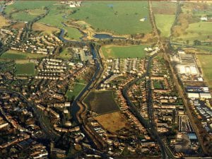
The Virtual Dig is a project jointly produced by South Cheshire College and Middlewich Town Council. It gives you an aerial view of Middlewich from which you identify and zoom into potential locations for a dig. If the dig is succesful you are rewarded with some information about your ‘find’.
 How to find your way through the Virtual Dig
- The dig first provides you with some very useful information – click ‘next’ to proceed through the pages.
- Next an aerial view of Middlewich will be displayed – look for potential dig sites by moving mouse pointer over the scene.
- The Mouse pointer changes to a pointed index finger when it is over an area of interest – click on this area to zoom in.
- Each click zooms in closer and when zoomed right in you may be lucky enough to make a ‘find’ and an information panel about the ‘find’ will pop up.
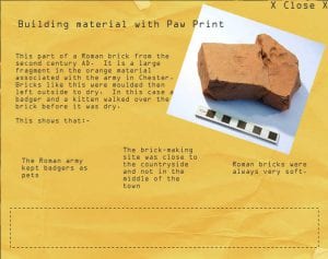
- The find information panel will also contain 3 sentences about what the find means but are they correct? – Click on the information and the answer will be given in the panel below.
 Click ‘X CLOSE X’ to exit the information panel and carry on digging.
- Click ‘Finish’ at the bottom right corner of the aerial view when you have finished your dig.
To get started click: Start Virtual Dig